Western Disturbances to Bring Rain & Snow to J&K, Himachal & North Punjab | Delhi Heatwave Incoming.
Western Disturbances to Bring Rain & Snow to J&K, Himachal & North Punjab | Delhi Heatwave Incoming.
Rain Coming: Western Disturbances to Hit India – Trigger Rain & Snow in These States (April 16-19, 2026).
As April 2026 enters its second half, two fresh Western Disturbances are approaching northwest India. While the systems are relatively mild compared to earlier active spells, they will bring much-needed moisture to the higher reaches of the Himalayas and surrounding hills, offering temporary relief from the advancing summer heat.

What Are Western Disturbances?
Western Disturbances (WDs) are extra-tropical weather systems originating in the Mediterranean or Caspian Sea region. They travel eastward, bringing moisture-laden clouds that interact with the Himalayan topography. In winter and early spring, they cause widespread rain, snow, and hail across North India. Even in April, they can trigger unseasonal precipitation, cooling temperatures and occasionally bringing hailstorms.

More rain on its way: India to be drenched by new western disturbance. Here's when
What Are Western Disturbances?
Western Disturbances (WDs) are extra-tropical weather systems originating in the Mediterranean or Caspian Sea region. They travel eastward, bringing moisture-laden clouds that interact with the Himalayan topography. In winter and early spring, they cause widespread rain, snow, and hail across North India. Even in April, they can trigger unseasonal precipitation, cooling temperatures and occasionally bringing hailstorms.
More rain on its way: India to be drenched by new western disturbance. Here's when
April 2026 has already witnessed unusually frequent Western Disturbances, leading to multiple spells of rain, hail, and cooler days — a welcome break before the intense summer heat sets in.
Upcoming Western Disturbances: Impact (April 16-19)
The first mild WD is expected to affect the region between April 16 and 17, followed by a second system from April 18 to 19.
Affected Regions & Expected Weather:
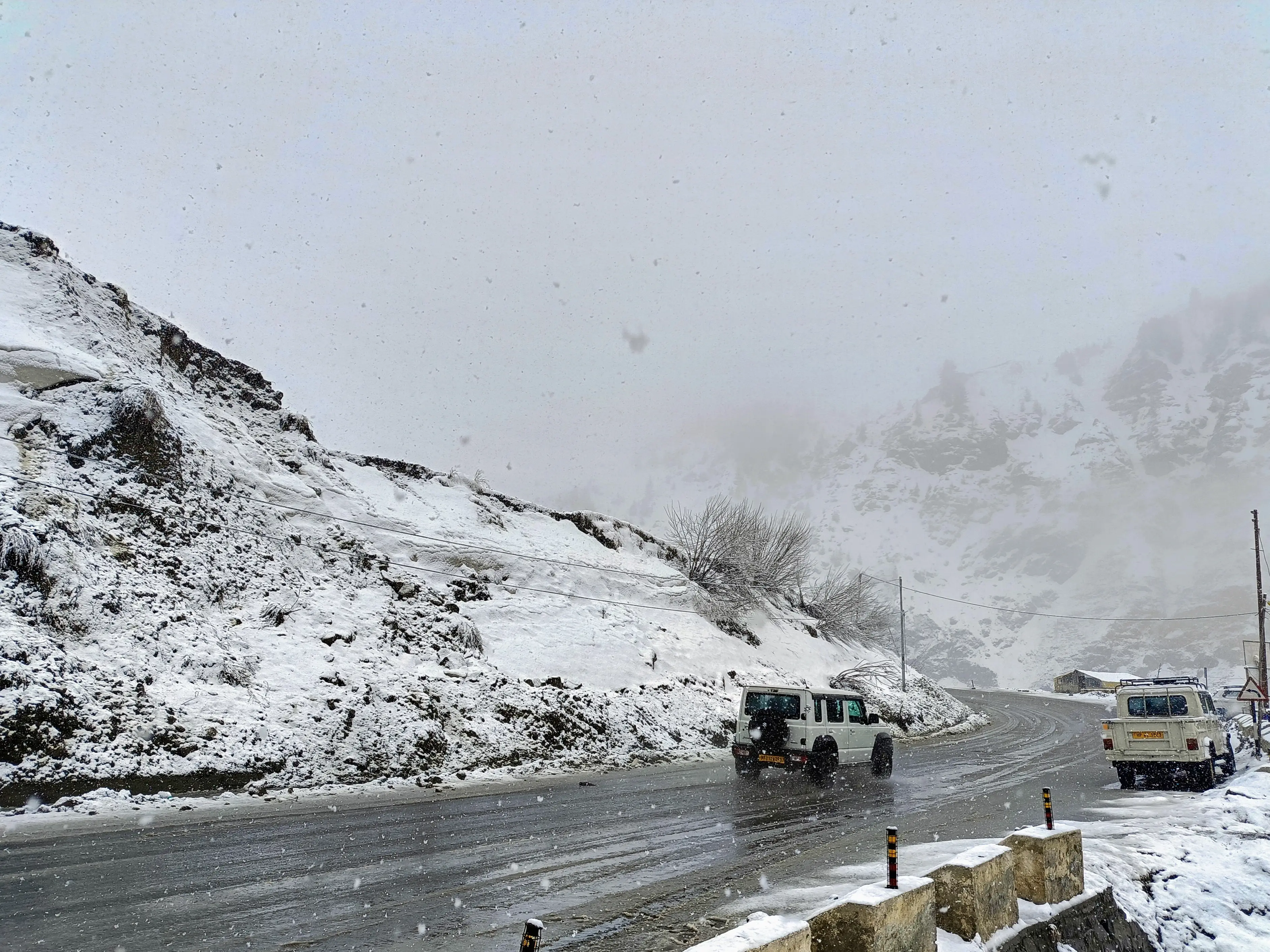
1. Higher Reaches of Jammu & Kashmir
Light to moderate rain and snow likely above 2,500 metres.
Possible thunderstorm and hail at isolated places.
Lower valleys may see light showers.
Road conditions in higher passes (e.g., Zojila, Sinthan) may deteriorate.
&imwidth=800&imheight=600&format=webp&quality=medium)
Fresh western disturbance triggers snowfall, rain; authorities warn of landslides
2. Himachal Pradesh
Rain/snow in higher hills (Lahaul-Spiti, Kinnaur, Kullu, Chamba).
Light rain possible in mid-hills.
Plains of Una and Hamirpur largely dry.
Cool and cloudy conditions will persist.
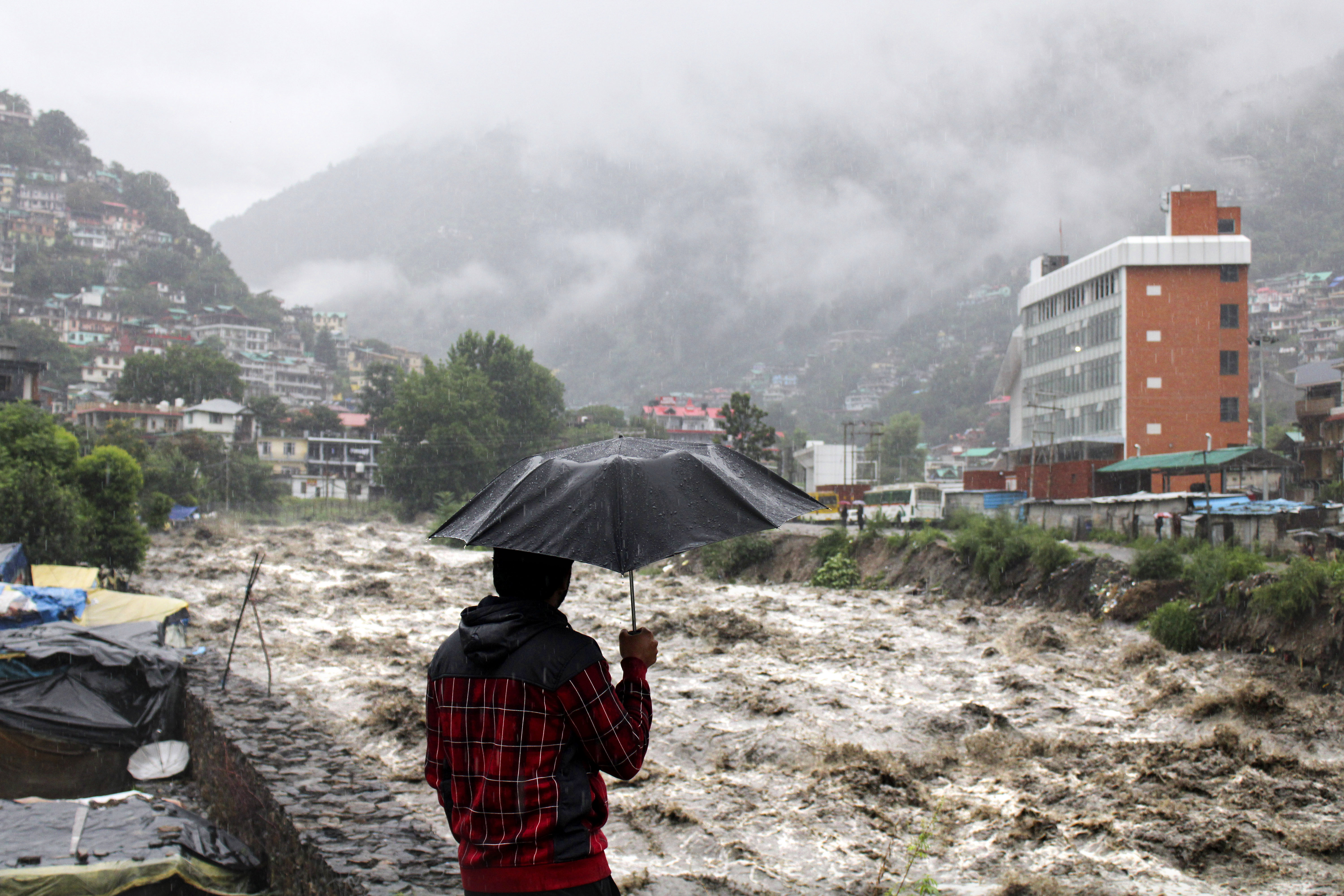
Himachal Pradesh in India hit with climate-change caused monsoon flooding.
Rain/snow in higher hills (Lahaul-Spiti, Kinnaur, Kullu, Chamba).
Light rain possible in mid-hills.
Plains of Una and Hamirpur largely dry.
Cool and cloudy conditions will persist.
Himachal Pradesh in India hit with climate-change caused monsoon flooding.
3. North Punjab & Adjacent Areas
Isolated light rain or thundershowers possible in northern districts (Pathankot, Gurdaspur, Amritsar).
Isolated light rain or thundershowers possible in northern districts (Pathankot, Gurdaspur, Amritsar).
Most parts of central and southern Punjab will remain dry.
Snow, hail and rain to continue in Himachal Pradesh on April 8; orange and yellow warnings issued.
Plains of Northwest India (Haryana, Delhi-NCR, Rajasthan, Uttar Pradesh) → Largely dry with only passing clouds. No widespread rain expected.
Other States
Uttarakhand: Light rain/snow in higher reaches.
Isolated activity possible in parts of Madhya Pradesh and East Rajasthan due to induced systems.
&imwidth=800&imheight=600&format=webp&quality=medium)
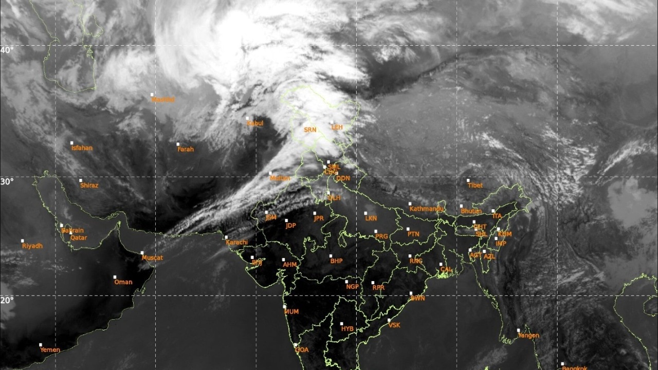
Satellite images show widespread clouds as Western disturbance triggers rain across North India.
Delhi-NCR: Summer Heat Returns Strongly
While the hills get some moisture, Delhi-NCR is bracing for a sharp rise in temperatures.
IMD Forecast:
April 16: Max 39–41°C | Min 24–26°C
April 17: Max 40–42°C | Min 26–27°C
Clear to partly cloudy skies. No significant rainfall.
Heatwave conditions (≥40°C) likely for the first time this season.

On the sweltering streets of India amid deadly heatwave - June 3, 2024.
Uttarakhand: Light rain/snow in higher reaches.
Isolated activity possible in parts of Madhya Pradesh and East Rajasthan due to induced systems.
Satellite images show widespread clouds as Western disturbance triggers rain across North India.
Delhi-NCR: Summer Heat Returns Strongly
While the hills get some moisture, Delhi-NCR is bracing for a sharp rise in temperatures.
IMD Forecast:
April 16: Max 39–41°C | Min 24–26°C
April 17: Max 40–42°C | Min 26–27°C
Clear to partly cloudy skies. No significant rainfall.
Heatwave conditions (≥40°C) likely for the first time this season.
On the sweltering streets of India amid deadly heatwave - June 3, 2024.
This marks the end of the pleasant weather brought by earlier Western Disturbances. Nights will also turn warmer, increasing discomfort. Residents are advised to:
Stay hydrated
Avoid outdoor activities between 12 PM and 4 PM
Use light cotton clothing
Check on elderly and children
Why So Many Western Disturbances in April 2026?
Meteorologists note that climate patterns are shifting. Frequent WDs in spring are becoming more common, sometimes delaying the full onset of summer. However, once these systems pass, the subtropical high-pressure system strengthens, leading to rapid temperature spikes — exactly what Delhi-NCR is experiencing now.
Impact on Daily Life & Agriculture
Positive Impacts:
Moisture in hills helps rabi crops in final stages.
Snow in higher Himalayas replenishes glaciers and rivers.
Temporary cooling reduces heat stress on people and livestock.
Challenges:
Hail can damage standing crops and orchards in Himachal & J&K.
Slippery roads and reduced visibility in hilly areas.
Sudden temperature swings affect health, especially for those with respiratory issues.
IMD Advisory
The India Meteorological Department urges people in hilly regions to:
Check weather updates regularly
Avoid unnecessary travel in higher altitudes
Secure loose objects against strong winds
For plains, focus on heat safety protocols as summer arrives in full force.
Long-Term Outlook
After these two mild disturbances, the next 7–10 days are likely to see mostly dry conditions across northwest India. Temperatures will gradually rise further, with 42–45°C possible in parts of Rajasthan and Delhi by the end of April if no new system develops.
Farmers in rain-fed areas should utilise any light showers effectively, while urban residents should prepare for the peak summer months ahead.
Stay Updated: Follow official IMD bulletins and state disaster management alerts for real-time changes. Weather can shift quickly in April.
This comprehensive update combines the latest satellite observations, IMD models, and ground-level impacts to help you plan better for the coming days.
#WesternDisturbance #IMD #DelhiHeat #NorthIndiaWeather #April2026
Comments
Post a Comment