Tsunami Warning Eased in Tonga After 7.6 Magnitude Earthquake Near Neiafu – No Damage or Casualties Reported.
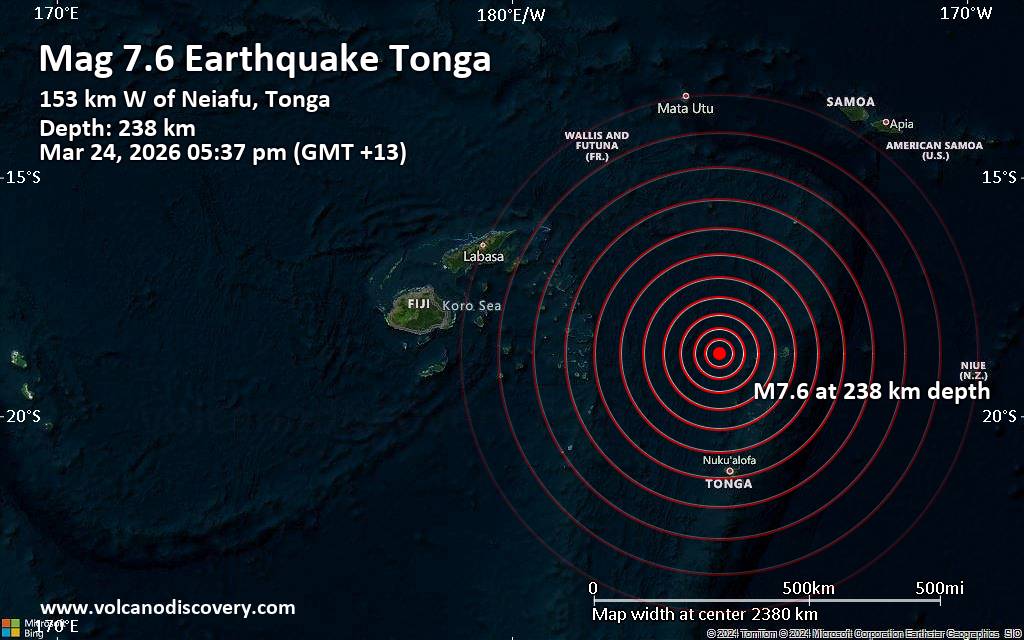
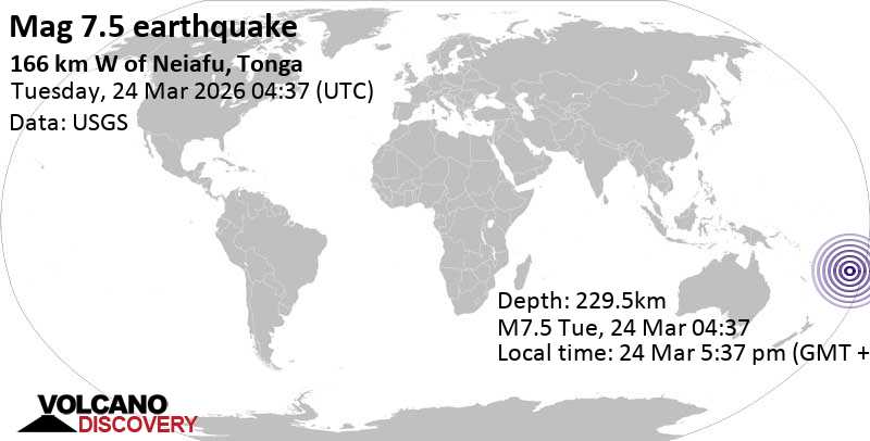
On Tuesday, March 24, 2026, a powerful 7.6 magnitude earthquake struck in the South Pacific Ocean, approximately 153–166 km west of Neiafu, the second-largest town in the Kingdom of Tonga.
The tremor, which occurred in the afternoon local time (around 5:37 pm), initially triggered a nationwide tsunami warning from Tongan authorities, causing brief anxiety across the island nation. However, the warning was quickly eased later that day as assessments confirmed no significant tsunami threat materialized.
The United States Geological Survey (USGS) reported the quake at a depth of approximately 229.5–238 km beneath the seabed. This intermediate-to-deep focus significantly reduced the risk of a destructive surface tsunami, as confirmed by the Pacific Tsunami Warning Center (PTWC) in Hawaii.
Earthquake location map showing the epicenter west of Neiafu in the Vavaʻu group, with intensity rings across Tonga and neighboring regions.
Timeline of Events and Official Response
The quake was widely felt across Tonga, including the capital Nukuʻalofa on Tongatapu island and the northern Vavaʻu archipelago. Shortly after the event, the Tonga Meteorological Services and the National Disaster Risk Management Office issued an urgent tsunami warning. Statements posted on social media platforms warned that “a dangerous tsunami could occur in minutes” and advised residents in coastal areas to move immediately to higher ground or inland.
Sirens sounded in Nukuʻalofa and other locations, prompting precautionary evacuations. Footage shared by local media showed people gathering on rooftops and heading to elevated areas as a safety measure.
Despite the initial alert covering multiple island groups — Vavaʻu, Tongatapu, ʻEua, Haʻapai, and the Niuas — the Pacific Tsunami Warning Center quickly clarified that no tsunami threat existed because the earthquake was located too deep inside the Earth. Deep quakes (generally over 70 km) rarely generate large tsunamis, as they do not displace sufficient seawater at the surface.
Later on Tuesday, the Tonga Meteorological Services issued an update on Facebook confirming that the tsunami warning had been eased for all affected areas. Officials stated that conditions had stabilized, and there were no immediate reports of casualties or significant structural damage.
Aerial views of Neiafu, the main town on Vavaʻu island, situated along a deep-water harbour. Its coastal location makes it particularly sensitive to seismic and tsunami alerts.
Why the Depth Mattered: Understanding the Science
Earthquakes are measured by magnitude (energy released) and depth (how far below the surface the rupture occurs). A magnitude 7.6 event is considered a major earthquake, capable of causing strong shaking near the epicenter. However, when the focus is deep — in this case over 230 km — the seismic waves lose intensity before reaching the surface, resulting in less violent ground motion and minimal vertical displacement of the ocean floor.
The Tonga Trench, part of the Pacific Ring of Fire, is one of the most seismically active regions on the planet. The islands sit near a subduction zone where the Pacific Plate dives beneath the Australian Plate, generating frequent earthquakes and occasional volcanic activity.
In this instance, the depth prevented the kind of shallow rupture that triggered the devastating 2022 Hunga Tonga-Hunga Haʻapai volcanic eruption and tsunami. That earlier event caused widespread destruction, loss of life, and global atmospheric effects. By contrast, the March 24, 2026 quake, while strongly felt, posed far lower risk.
Tsunami warning for Pacific Islands lifted after strong earthquake near Tonga.
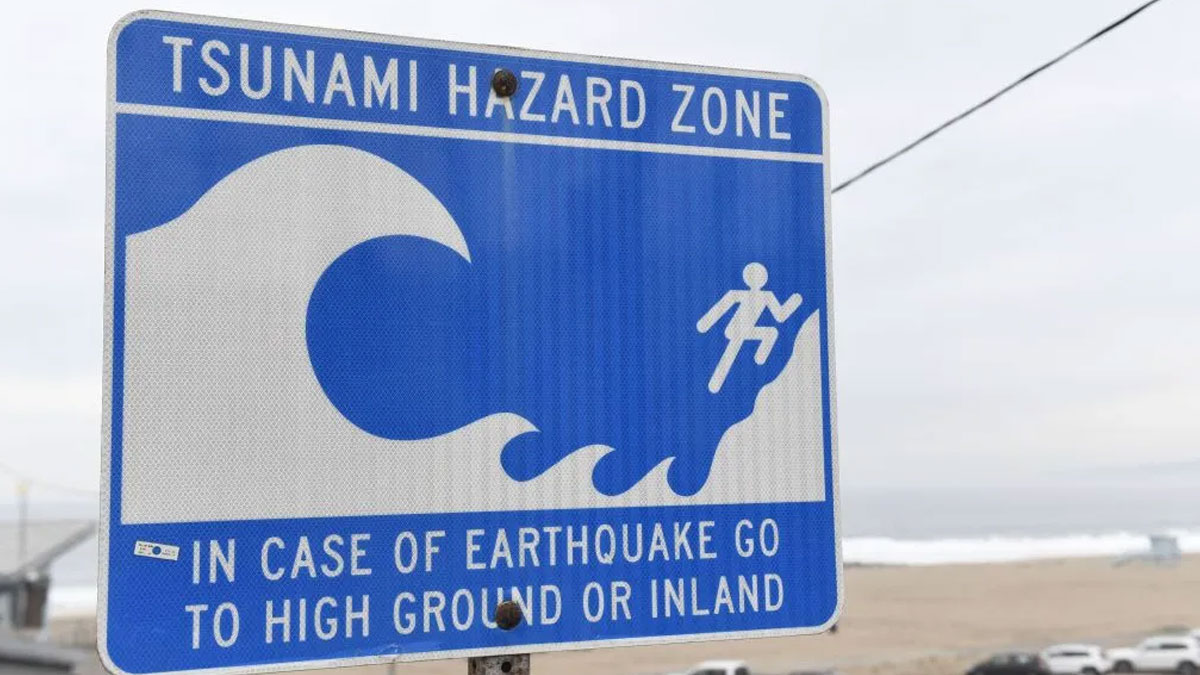
Tsunami hazard signage commonly seen in Pacific island nations, reminding residents to head to higher ground in case of strong earthquakes.
Impact on Neiafu and Vavaʻu Islands
Neiafu, with a population of around 4,000, serves as the administrative and economic hub of the Vavaʻu group. The town lies along a sheltered deep-water harbour famous for yachting, whale watching, and tourism. Its low-lying coastal areas and surrounding villages are vulnerable to sea-level changes, which is why authorities acted swiftly with the initial warning.
Residents reported feeling the tremor for up to two minutes, describing it as a prolonged rolling motion rather than sharp jolts. No major infrastructure damage — such as to harbours, roads, or buildings — has been reported so far. Damage assessments by the National Disaster Risk Management Office continued into the following days.
The event served as a timely reminder for communities in this seismically active region. Tonga has experienced several significant earthquakes and tsunamis in recent decades, including the 2022 volcanic event that highlighted gaps in communication and preparedness.
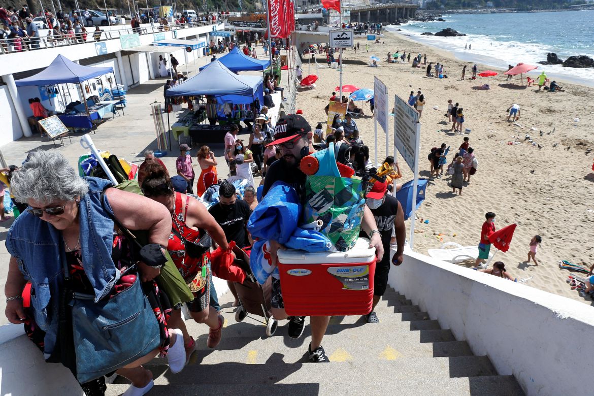
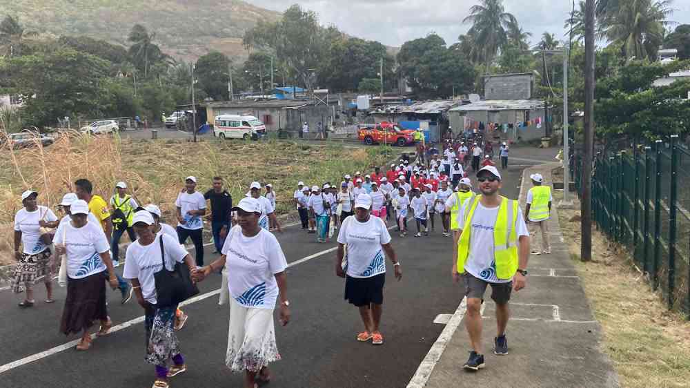
Community preparedness in action — residents participating in tsunami evacuation drills or moving to higher ground during alerts, a common sight in Pacific nations.
Regional and International Reactions
Neighboring countries monitored the situation closely:
New Zealand’s National Emergency Management Agency (NEMA) stated there was no tsunami threat to New Zealand.
Guam and the Northern Mariana Islands received reassurance from the Pacific Tsunami Warning Center that no threat existed.
Fiji, Samoa, and other Pacific islands also reported feeling minor shaking but issued no local warnings.
International seismological agencies, including the European-Mediterranean Seismological Centre and Germany’s GFZ, provided corroborating data, with some initially reporting slightly lower magnitudes (7.4–7.5) before converging on the USGS figure of 7.6.
No aftershocks strong enough to cause additional concern were immediately reported, though authorities advised residents to remain vigilant.
Broader Context: Living on the Ring of Fire
Tonga is no stranger to seismic activity. The nation lies directly on the Pacific Ring of Fire, a 40,000 km horseshoe-shaped zone where tectonic plates collide, causing about 90% of the world’s earthquakes and most of its volcanic eruptions.
This geological reality means Tongans are among the most tsunami-aware populations globally. Regular drills, early-warning systems, and community education programs have been strengthened since the 2009 Samoa-Tonga tsunami and the 2022 Hunga Tonga disaster.
The swift issuance — and subsequent easing — of the March 24 warning demonstrates improved coordination between local meteorological services, the National Disaster Risk Management Office, and international bodies like the PTWC.
Lessons and Ongoing Preparedness
While this earthquake caused no reported harm, it underscores several important points for small island developing states:
Depth is critical — Deep quakes, even of high magnitude, rarely generate destructive tsunamis.
Rapid communication saves lives — The initial warning, though precautionary, allowed residents to take safe action.
Community resilience — Tonga’s experience with previous disasters has built strong public awareness and response mechanisms.
Need for continued investment — In seismic monitoring, siren systems, evacuation routes, and public education.
As climate change raises sea levels, low-lying atolls and coastal communities in Tonga and across the Pacific face compounded risks from both seismic events and gradual inundation.
Final Update: Situation Stable
By late Tuesday, March 24, 2026, Tongan officials confirmed the tsunami warning had been fully eased across all affected island groups. No injuries or major damage were reported. The country returned to normal operations, though monitoring continued for any potential aftershocks.
This event, while alarming in the moment, ended without tragedy — a testament to effective early warning systems and the relatively benign nature of a deep-focus earthquake.
For residents of Tonga and the wider Pacific, such incidents reinforce the importance of staying informed through official channels and knowing the simple rule that has saved countless lives: “When the ground shakes hard, move to higher ground.”
The people of Tonga once again demonstrated calm and resilience in the face of nature’s power.
Vava'u on a cruising sailboat - by Jim Yares.
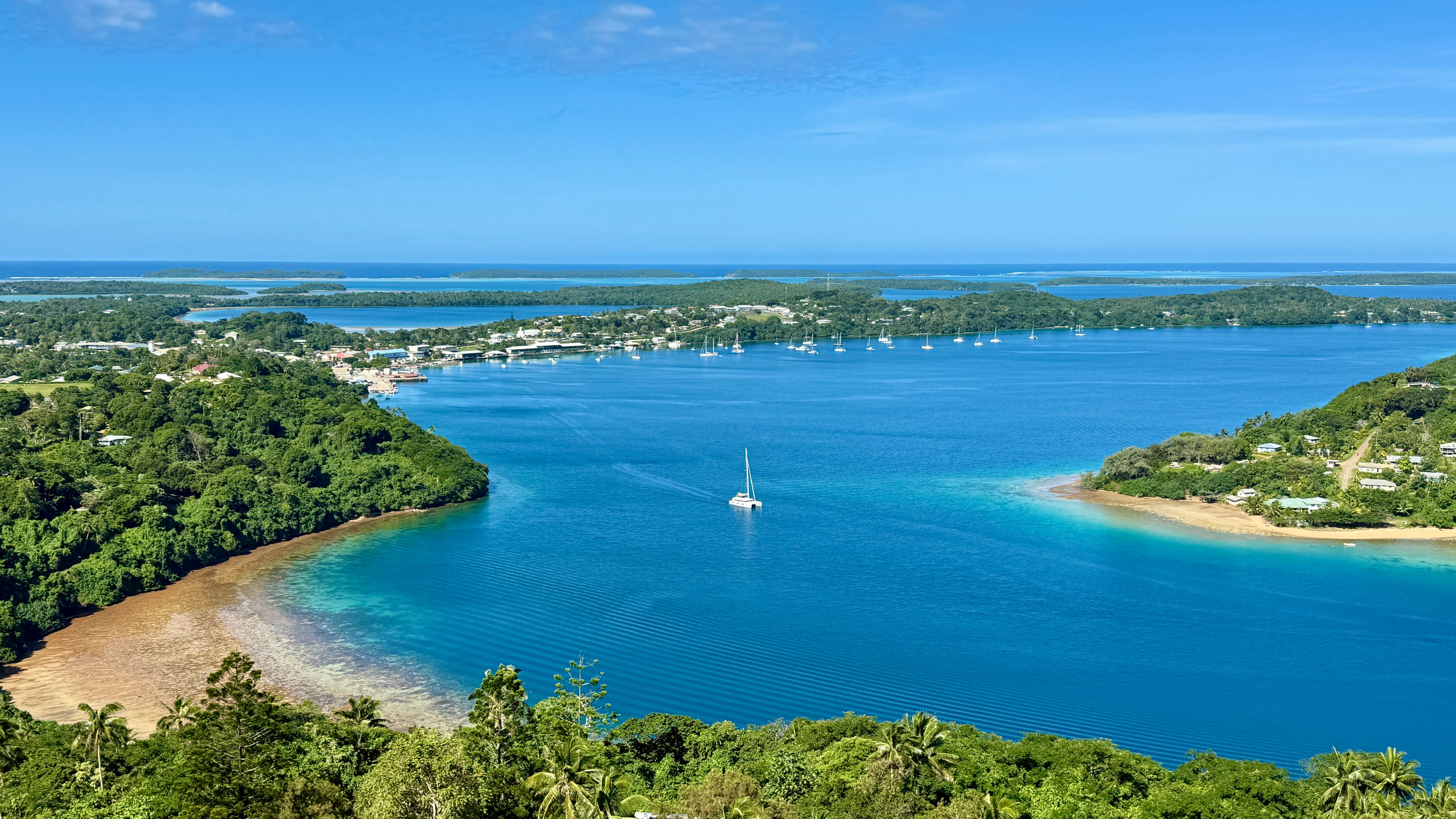
Panoramic view of Vavaʻu islands, highlighting the beautiful yet seismically active coastal landscapes that define life in Tonga.
Stay safe and always follow official guidance during seismic events in the Pacific.
Comments
Post a Comment